

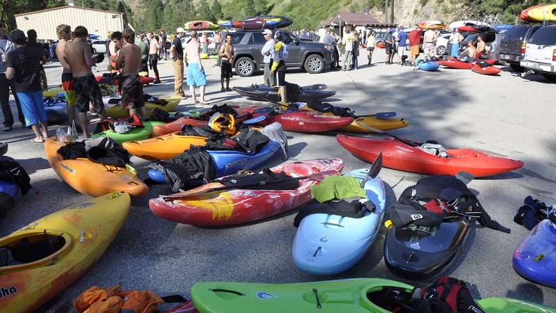
It can be discouraging lacing up boots, packing trail mix, and driving hours to a favorite trailhead only to find that a hundred other people had the same idea. Overcrowding is an ongoing issue at recreation sites across the West, with packed parking lots, overloaded boat ramps, and crowded trailheads.
To make tough decisions about well-loved places, land managers have to understand the problem. How often does parking spill out of crowded lots? How long do boaters have to wait to launch? How many people are using a given trail? Answering these questions faces a major challenge — the daunting task of tracking recreation trends across dispersed access points and scattered destinations, says Jordan Smith, director of the Institute of Outdoor Recreation and Tourism.
Various tools are used — surveys, mechanical counters, and in-person observations. But traditional tracking methods have a big tradeoff between cost and accuracy, said Chase Lamborn, assistant director of the institute.
“Collecting that kind of high-quality data requires a substantial amount of staff time, especially when you are trying to understand trends across a lot of sites over an entire season,” Lamborn said.
Artificial intelligence offers a new way to help. Smith and Lamborn decided to ask if AI could help managers better understand recreation patterns without dramatically increasing the cost of monitoring.
In partnership with the U.S. Forest Service, the researchers tested the approach along the heavily used Payette River recreation corridor in Idaho. They used high-resolution aerial imagery to map where parking was available across the corridor. They installed cameras at recreation sites along the river to photograph activity over time (without collecting personal information). Computer vision tools — algorithms that identify and count objects in images and video — were trained and processed nearly a half-million images to identify the presence of vehicles in parking areas and watercraft on the river.
The data they gathered provided a surprisingly detailed picture of recreation capacity in the corridor and how much of that capacity was being used. It showed where people concentrated, when demand peaked, and where physical bottlenecks occurred.
The new approach demonstrates how AI could let land managers monitor large recreation areas more consistently and efficiently than would be practical through traditional methods, Lamborn said.
The researchers turned photographs into continuously updated metrics — identifying crowding hotspots, estimating parking demand, and providing a more complete picture of recreation use. Managers could use this information for planning, to prioritize projects and build infrastructure to improve the recreation experience and safety, Smith said.
Details about the methodology were recently published in the journal Machine Learning with Applications, and results were used by the Institute of Outdoor Recreation and Tourism for developing the Payette River Recreation Management Plan.
The value of the approach is not just that AI can automate part of the monitoring process, Lamborn said — it’s that it offers substantially better information without substantially bigger budgets. Traditional monitoring is limited by budgets, creating tradeoffs between the number of sites monitored, the amount of data collected, and the level of detail managers receive.
“Doing it well requires massive data sets,” Lamborn said. “If we were doing it by hand, it would take literally thousands of employee-hours to work through.”
Another benefit of the new approach is that it improves the product without replacing people.
“We hire the same number of staff, often students, to provide the same hands-on training and professional experience within roughly the same budget. The difference is that we can now collect and process far more information than was previously possible. It gives our funding partners better information, while still providing valuable work experience,” Lamborn said.
“In practical terms, the same investment can support a better picture of how recreation sites are being used and where management attention may be needed most,” Lamborn said.
The researchers were highly cognizant of privacy concerns. They used fixed cameras to compile counts without identifying individuals or license plates. Technicians positioned cameras to avoid human faces and used the lowest practical resolution for object detection. They applied automatic digital masks to sensitive areas and deleted raw photos once automated counts were complete.
With proof of concept, the team has launched a Recreation Capacity Platform to share the approach more broadly. The platform combines aerial maps, camera counts, and environmental conditions into easy-to-use digital dashboards.
“The goal is to continue to advance real-time and privacy-first monitoring systems needed in a variety of outdoor recreation contexts,” Smith said. “As outdoor recreation participation continues to grow, the public needs smarter systems to know when and where to have the kind of recreation experiences that they want.”
WRITER
Lael Gilbert
Public Relations Specialist
S.J. and Jessie E. Quinney College of Agriculture & Natural Resources
435-797-8455
lael.gilbert@usu.edu
CONTACT
Jordan Smith
Director
Institute of Outdoor Recreation and Tourism
435-830-6294
Jordan.smith@usu.edu
Research1179storiesWater347storiesLand Management174storiesOutdoor112storiesConservation100storiesRecreation82storiesArtificial Intelligence43stories
SHARE
Comments and questions regarding this article may be directed to the contact person listed on this page.
